
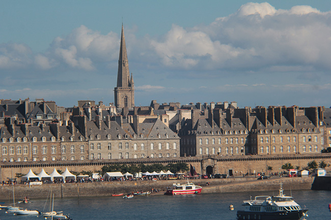
The Post-War Reconstruction of Saint-Malo
On 9th November, 138 solo sailors will set off from France’s sail racing capital, Saint-Malo, bound for Pointe-à-Pitre in the French Caribbean island of Guadeloupe. But how many of those involved will know that 2022 also marks the 50th anniversary of the erection of Saint-Vincent cathedral’s spire, the finishing touch in the reconstruction of the port in northern Brittany, 80% destroyed by U.S. bombs and a fire in August 1944?
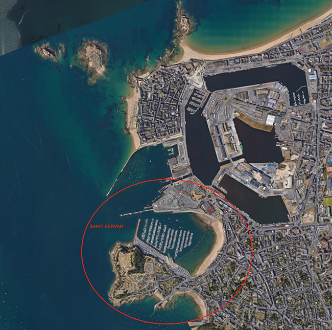
Saint-Servan © Google Maps
Historian and director of the Saint-Malo Museums, Philippe Petout wonders whether the city wasn’t bombed by mistake instead of the cité d’Aleth just a few hundred metres south, where the Germans had transformed an 18th century fort into an air-defence bunker to control the estuary of the Rance river which runs 20 km south to north like an open scar through Brittany.
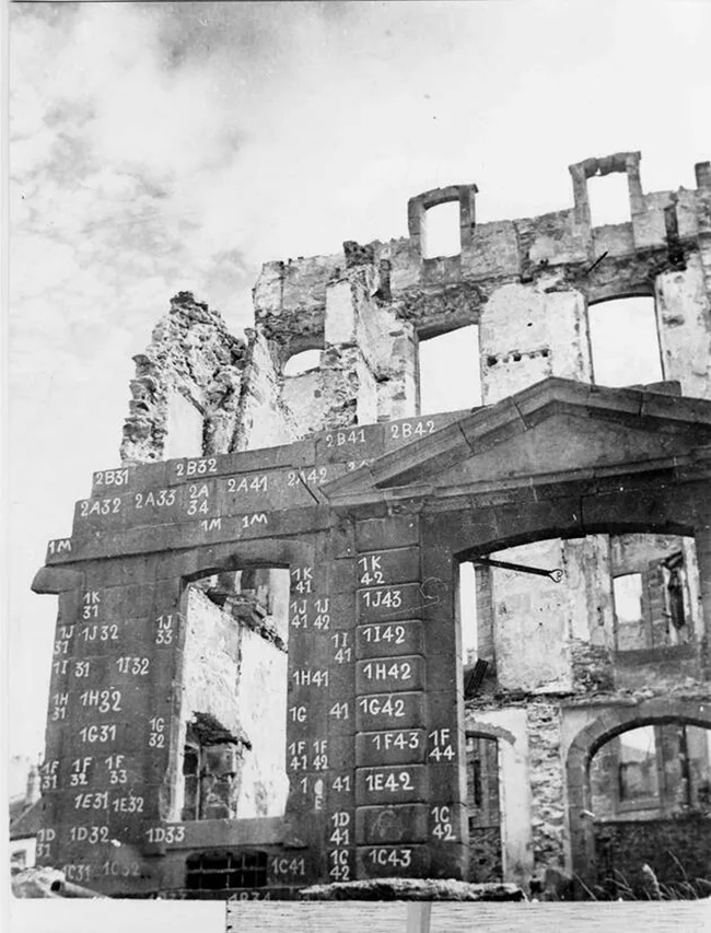
Numbering the stones to rebuild Saint-Malo. Photo from Saint-Malo archives.
Saint-Malo is built on a 15-metre high rocky outcrop where the eastern bank of the Rance river meets the English Channel. The outcrop is shaped like a south-facing double-pointed hook. The right hook is narrowly linked to the north of the Anse des Sablons, a deep bay shaped like a round pocket open at its western end into the Rance. The south of this bay is formed by another rocky outcrop, almost exactly the same size as the one Saint-Malo was built on, and that is where the cité d’Aleth sits. It’s easy to mistake the two, which are less than one kilometre apart, particularly in the days of somewhat haphazard bombing.
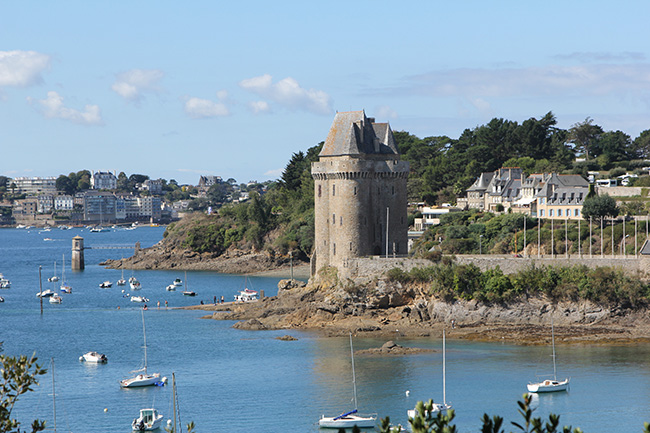
The Tour Solidor with views across the Rance to Dinard © Christina Mackenzie
Today, many tourists who fill the streets and restaurants of Saint-Malo from April to October don’t bother visiting the cité d’Aleth where the German fortifications are now a war memorial and museum. So they don’t realise that instead of waiting for a table at an overcrowded restaurant in the walled city they could simply stroll across to the Saint-Servan neighbourhood and quickly find a table on the Quai Solidor with views across the river to Dinart and the spectacular 14th century Solidor Tower.
The German occupiers had unparalleled views from their observation point at the tip of the cité d’Aleth © Christina Mackenzie
The name Solidor comes from the Breton “steir dor” which means “river door”. Built in 1382 by Jean IV of Brittany to control access to Saint-Malo, the tower was a prison before becoming the Cape Horn Museum which exhibits mementoes from 16th-19th century sailing expeditions to Cape Horn.
Saint-Servan, or Alet as it used to be known until a cathedral was built in the 9th Century and it changed names, can trace its roots back to the Greco-Roman period when it was a rich and powerful city before Saint-Malo existed. But climate change and Vikings reversed the situation! Rising seas shrank the size of Saint-Servan’s port whilst allowing a bigger one to be built in Saint-Malo. And many Servanais fled repeated Viking attacks, seeking refuge on the more easily defendable rock of Saint-Malo.
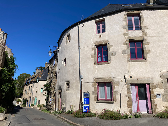
The 17th and 18th century houses in Saint-Servan were not destroyed in WWII © Christina Mackenzie
A small remnant of wall by the side of the footpath that starts behind the marina is all that remains of the Greco-Roman period. Visitors then make a jump of almost 2,000 years when they walk past the first of a number of badly damaged, one person “Z.10 114a neu” bunkers with a “20P7 cupola”.
A little further along the path visitors will notice a sign to “Mémorial 39/45”. Under the ruins of an 18th century fort, the Germans dug two kilometres of galleries to link the bunkers. They installed observation posts, communications centres, and living quarters, including kitchens and an infirmary, for up to 200 people in these galleries. The section that includes the observation bunker and the restored artillery command centre are only open from June to the end of September. The rest of the museum is open year-round.
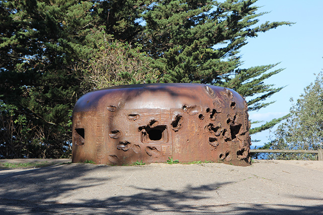
114a neu 20P7 cupola bunker © Christina Mackenzie
One can walk around the cité d’Aleth peninsula and through the narrow, medieval streets of Saint-Servan which were not damaged during WWII, unlike those of Saint-Malo whose sturdy stone ramparts survived the bombing and the fire but could not protect the city from airborne attacks. Of the 865 mostly wooden houses, 683 were damaged.
The reconstruction is so well done that many visitors might not be aware the city they are touring was built between 1947 and 1972. Petout remarks that this reconstruction “can be considered as one of the most remarkable of the 20th Century.” He notes it introduced contemporary comforts for the inhabitants but “through the materials used and the overall plan” still manages to evoke the port’s history.
The Saint-Vincent cathedral spire was only erected in 1972 © Christina Mackenzie
The first post-war idea was to raze the town and build a new one from scratch like Le Havre and Brest. But city authorities finally opted for reconstruction despite the mammoth task of sorting through 500,000 cubic metres of rubble. Stones on partially standing buildings were carefully numbered before being dismantled and stored so that they could be used in the rebuild. The first stone of the new Saint-Malo was laid at n° 9 rue d’Estrées on 26th January 1947. Forty years later, a commemorative plaque was put up on that building.
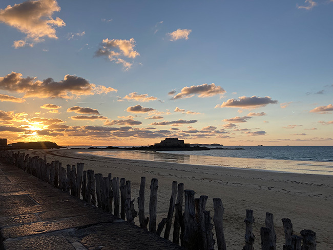
The long sandy beaches and island fortresses, like this 17th century granite National Fort, are amongst the major draws to Saint-Malo © Christina Mackenzie
The new town is much airier and less densely built-up than the medieval town had been. Roads were broadened, narrow alleyways disappeared, modern plumbing was introduced. But for visitors, the draw is really the ramparts, the long sandy beaches and the extraordinary racing sailboats that are frequently tied up quayside.
The city boasts one of the biggest tidal ranges in Europe, rising and falling by as much as 15 metres in the spring and autumn, so visitors can walk out to some of the fortress-covered islands that dot the seascape… as long as they walk back before the tide comes in! And that’s also why the starting gun for the 2022 Route du Rhum will blow at precisely 2.15pm.
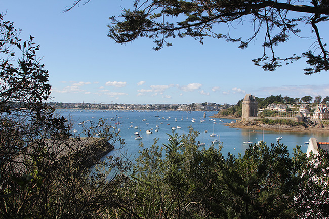
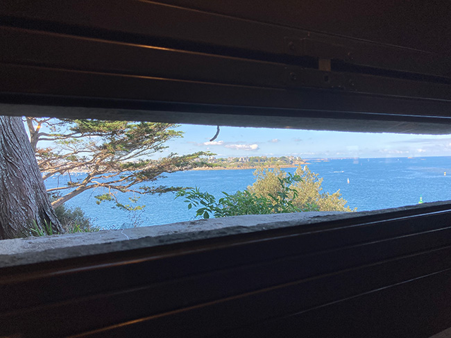
Lead photo credit : From the pathway around the cité d’Aleth there are lovely views across the Anse de Solidor to Dinard on the opposite banks of the Rance © Christina Mackenzie
Share to: Facebook Twitter LinkedIn Email
More in brittany activities, Saint-Malo, Second World War
Related Posts
Leave a reply
Your email address will not be published. Required fields are marked *
REPLY