
Thrilling Ride: Cycling the Mountain Passes Near Annecy
With its mesmerizing blue waters, circled by rising mountains, Annecy is fantastic cycling country, whether you want lakeside flat paths and gruelling ‘col’ climbs.
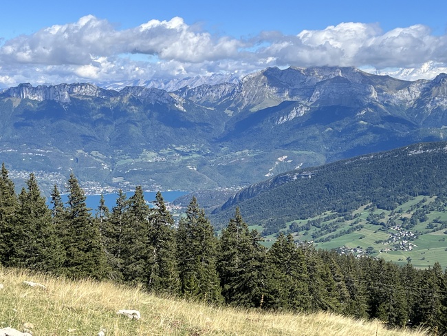
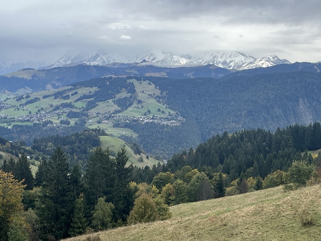
A third of the way up the Arpettaz © Steve Wartenberg
It was my last ride from Annecy.
“Should I do it?” I asked myself.
“Can you even do it if you try?” I responded. “Do you have the legs?”
“It” was the Col de l’Arpettaz, one of the longest, steepest and most grueling climbs here in the Auvergne-Rhône-Alpes region surrounding Annecy. While Annecy is a popular destination, known for the shimmering Lac d’Annecy, the canals and cobbled streets of the old village, the restaurants and nightlife, it’s also a magnet for cyclists of all levels. This was my second cycling adventure in Annecy, and I was determined to revisit some old favorites and climb some new cols (mountain passes). This is a town where you can stay for a week or two, and every day go on a different and beautiful ride.
Before I describe my attempt to climb the Arpettaz, here are the rides I did before my big test …
Just past Talloires-Montmin, on the edge of Lake Annecy © Steve Wartenberg
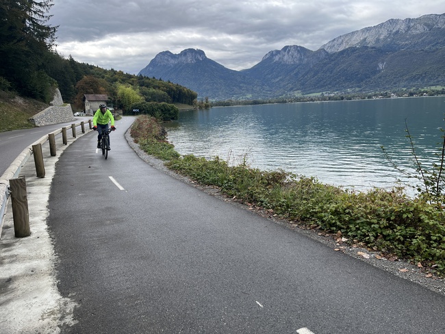
Ride 1: The Lac d’Annecy loop
This is a great introductory ride as you get to take in the beauty of the lake and draw inspiration from the surrounding mountains, some of which you can climb on your bike. Or eBike. It’s about a 25-mile, mostly flat ride.
Think of the lake as an elongated clock, perhaps painted by Salvador Dali. Annecy goes from 11:30 to 12:30. As you cycle clockwise, you’re immediately on the edge of the lake and then you ride through the villages of Menthon-St-Bernard and Talloires-Montmin and “lose” the view of the lake for a few kilometers. Then it reappears after Talloires-Montmin for one of the more dramatic stretches of the loop.
At the bottom of the lake (6 on the clock) there’s a tunnel under the busy D1508 that puts you on the path and heading north, back to Annecy. To your left are views of the imposing Montagne du Semnoz.
A word of warning: There’s a lot of traffic of all sorts in and around Annecy and on the path: cyclists, walkers and runners, parents with strollers, skateboarders and rollerbladers. So, be cautious and be careful. And slow down!
On the path headed to Albertville © Steve Wartenberg
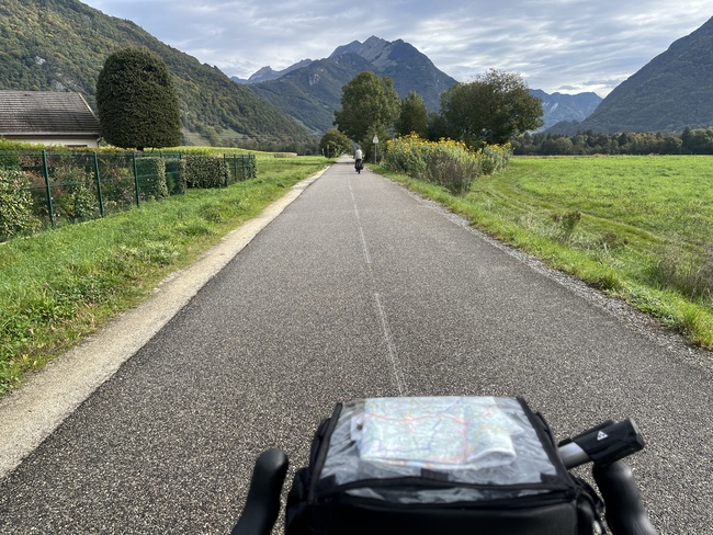
Ride 2: Albertville
Before we start climbing, I thought I’d toss in another flat ride. Albertville, host of the 1992 Winter Olympics, is about a 45-kilometer ride from Annecy. While this may sound a bit too far, it’s a relatively easy ride. The first half is along Lac d’Annecy (either side will do) and the second half is along a well-paved, flat path through a valley surrounded on either side by mountains.
Albertville is nestled below some large mountains and there are plenty of cafés and restaurants. If you’re not quite ready for a 90-kilometer ride, you can ride to the towns of Faverges (54 kilometers roundtrip) and Ugine (78 kilometers roundtrip) and still enjoy the views of the valley.
Semnoz © Steve Wartenberg
Ride 3: The Col de la Forclaz
I like to think of this as the introductory col ride. There are two ways up, from Talloires-Montmin (8.4 kilometers with an average gradient of 7.0 percent) or further south from the village of Vesonne (9.3 kilometers and an average gradient of 7.5 percent). The route sign at the bottom of the Vesonne climb states: “This is the hardest side … The gradient is severe right from the start and there are even some steeper sections to follow, but your efforts will be rewarded by the exceptional view of Lake Annecy from the summit. The pass has been featured in the Tour de France on several occasions. Happy cycling!”
The views on the way up and down, from either route, and at the summit are truly spectacular and worth the effort. There’s a café at the summit.
According to my Strava, this ride was 39 miles and included 2,842 feet of climbing.
Semnoz © Steve Wartenberg
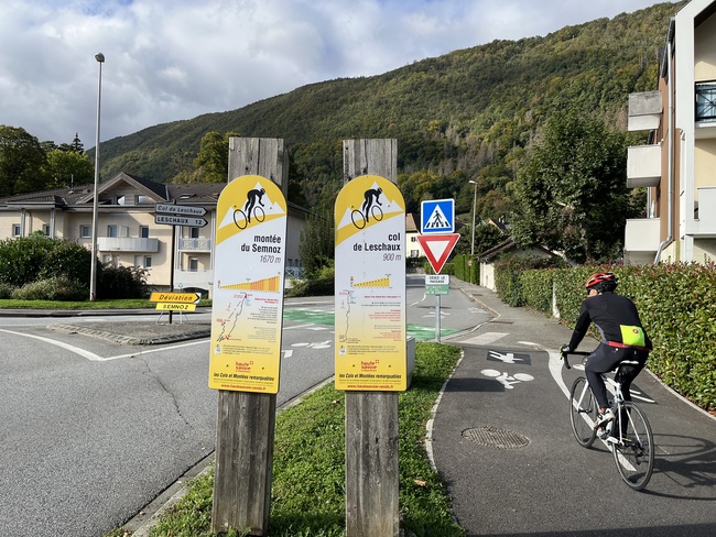
Ride 4: The Col de Leschaux and Montée du Semnoz
This is actually two climbs: 12 kilometers with an average gradient of 4.0 percent to the Col de Leschaux, and then another 13 kilometers with an average grade of about 6 percent to the Semnoz. The signs at the bottom states: “After warming up on the Col de Leschaux your legs will be in perfect shape to tackle the steeper ascent to the Semnoz.”
It’s a scenic warmup to Leschaux as you ride along the ridge of the Montagne du Semnoz with wonderful views down to the lake and then the valleys and mountains beyond. It’s more of the same to the summit of the Semnoz, but with a tougher gradient, a few S-curves and, depending on the weather, some cloud coverage.
Strava says this was 39 miles and 4,144 feet of climbing.
On this trip, it was a whiteout the last four or five kilometers so there wasn’t a view from the summit. The photo above is from my 2022 trip.
Up the Aravis © Steve Wartenberg
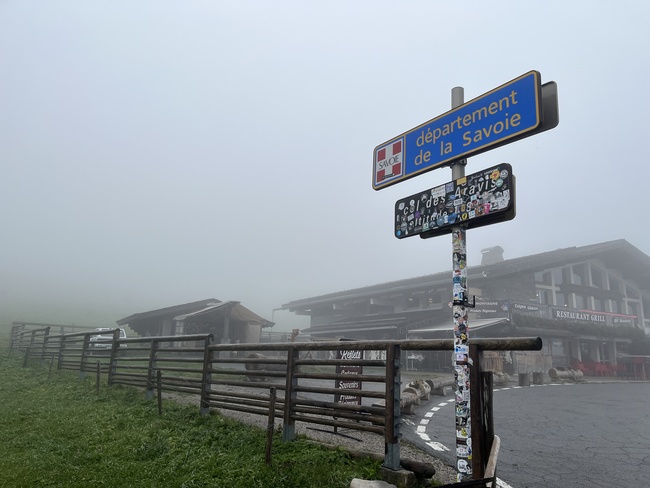
Ride 5: The Col des Aravis
Speaking of whiteouts, my long climb to the Col des Aravis was a whiter whiteout than the climb up the Semnoz. I wish I could describe the view on the way up and from the summit, but all I could see were clouds. And mist. And fog. Oh well, this happens on a bike trip in the mountains. Especially in October.
Here’s the route: From Annecy I rode up the Col de Bluffy and then on to Thônes where the real climbing began: 16.5 kilometers at an average gradient of 4.8 to the summit of the Aravis. This was a long day of riding (about 52 miles and 3,785 feet of climbing) and just might have been a spectacular ride if the weather and sun had cooperated. The photo above is from the misty/foggy summit.
Colombière © Steve Wartenberg
Ride 6: The Col de la Colombière
This is a legendary col that has been part of the Tour de France 23 times. And for good reason; it’s a difficult and beautiful climb.
First, an admission: I didn’t climb the Colombière on this trip but did it twice in 2022, from the town of Cluses, where I stayed in addition to Annecy. From Cluses it’s a 14.2 kilometer climb with an average gradient of 7.1 percent.
From Annecy, there are a few options. If you have a car, great, drive to Cluses and climb the col and ride back down to Cluses. If not, you can take the train to Cluses and ride to the summit of the Colombière and then down the other side to St-Jean-de-Sixt and back to Annecy. That’s about a 40-mile ride. Or ride back down to Cluses and take the train back to Annecy.
The photo above is from my 2022 ride.
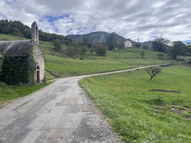
Tamie bridge © Steve Wartenberg
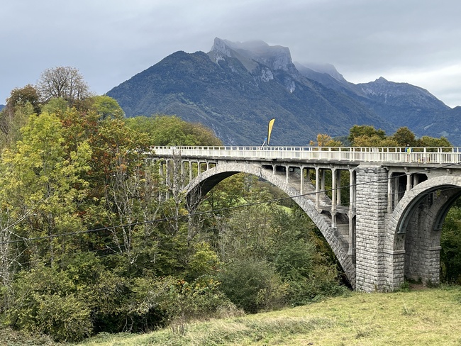
Ride 7: Col de Tamie
I’m calling this a pleasant ride because, well, the entire route was quite pleasant and not that difficult. And I got to see something quite thrilling.
Head south on the bike path (on either side of the lake, your choice) and continue toward Albertville. At the town of Faverges, make a right onto the D12 and follow it up to the col: 9.7 kilometers and average gradient of 4.0.
The route up was dotted with farms and little villages and was quite charming. There were lots of cows by the edge of the road. After about three kilometers I approached an old stone bridge that looked interesting. I rode onto it and there was a couple, tied together, standing on a platform on the edge of the bridge. A man was giving them instructions and checking their apparatus. They were about to take a bungee-jump leap! And I got to watch … and say to myself: “No way am I ever doing that.”
The rest of the ride to the summit was picturesque but a little anticlimactic after watching that couple in action.
The photo above is the bridge they jumped off.
View of Mont Blanc © Steve Wartenberg
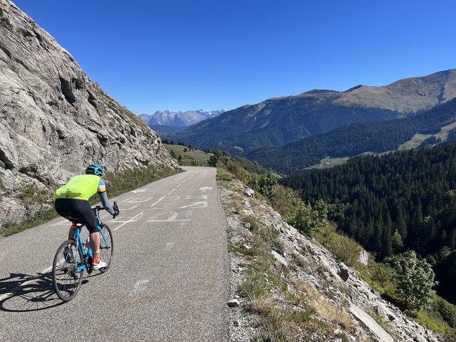
Ride 8: The Col de l’Arpettaz
My options for my last ride were the Colombière or the Arpettaz. I picked the col I had never ridden before and hoped my legs were ready for the longest, steepest ride of my trip.
You have to ride 35 kilometers (along the path toward Albertville) to the town of Ugine. This is where the climb begins. There are two ways up: 20.6 kilometers with a 5.8 percent gradient on the D109 or 14.5 kilometers with a 7.8 percent gradient on a road so small it doesn’t have a number.
I knew these statistics before the ride, from studying the mycols app on my phone, and wasn’t sure if I wanted to take the shorter but steeper route, or the longer but less-steep route. It was a dilemma, and I still wasn’t sure as I started climbing up and out of Ugine.
I got to the spot where the road split. To the right was the D109 route, to the left was the shorter, steeper route on the road with no name. The unnamed road had a sign saying it was the route for the Col de l’Arpettaz. The D109 didn’t. This was a sign. Literally. And so, I started up the shorter, steeper route.
It was a killer climb from the very start with no easy sections, just relentless steepness and series of S-turns (there must have been 30 of them) one after another. I struggled mightily and had to stop a few times to catch my breath. This ride was harder than the Semnoz and perhaps even the Colombière. But the views down to the valley were superb. And then, finally, I reached the top and was surrounded by even higher mountains in every direction. I took the D109 down and after about a kilometer I turned a corner and there it was: snow-covered Mont Blanc, looming high above all the other mountains. I may have gasped when I first saw it.
Then it was 20 kilometers downhill. The D109 was quite uneven and bumpy so I descended even more gingerly than usual, taking in the views. I reached the bottom and the town of Ugine and … realized I still had 35 more kilometers to ride to Annecy.
“OK, take your time, it’s flat, it’s easy, it’s a beautiful ride and your last ride on this trip, just savor and enjoy it.”
This ride was 70 miles and 4,762 feet of climbing. It’s a long and extremely difficult ride, but I’m glad I did it.
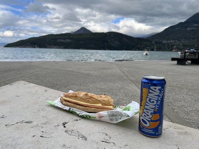
The perfect picnic lunch © Steve Wartenberg
Lunch: Boulangerie du Lac
At about 8 o’clock on the Lake Annecy loop “clock” is the town of Duingt. There’s a bicycle shop/café here, right off the path. But down the hill, closer to the lake and the D1508 road is the Boulangerie du Lac. This place makes superb baguette sandwiches, and I make a point to stop here whenever possible, except on Wednesdays (they’re closed). I get a sandwich and an Orangina. Across from the nearby church is a little park and benches right on the lake. This is my idea of the perfect Lake Annecy picnic.
Bike Rental:
I rented my bike through CCT Bikes. They work with local shops all over France, Spain and Italy to rent bikes. The local shop in Annecy I got my bike from was lemarcheduvelo.com.
Steve Wartenberg is a freelance writer and cyclist based in Columbus, Ohio. You can find his eBooks on biking different regions of France on etsy.
Lead photo credit : Semnoz © Steve Wartenberg
Share to: Facebook Twitter LinkedIn Email
More in adventure, alps, Annecy, cycling, lakes, moutains, outdoors
Related Posts
Leave a reply
Your email address will not be published. Required fields are marked *