
Cycling Cézanne’s Mountain
The sunlit roads around Montagne Sainte-Victoire, outside Aix-en-Provence, offer sweeping views and challenging climbs for the intrepid cyclist wishing to follow in Cézanne’s legacy.
Day after day, Paul Cézanne walked through Aix-en-Provence, heading east toward the base of his beloved mountain: Montagne Sainte-Victoire.
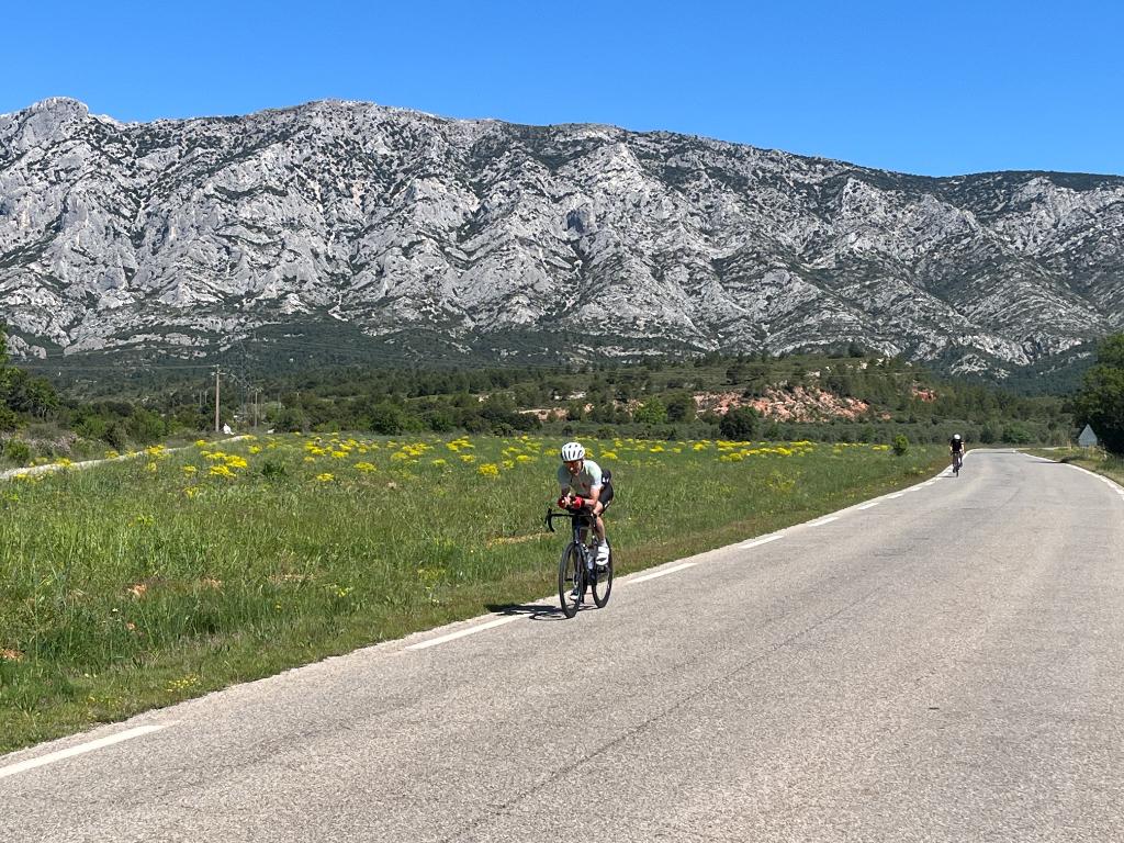
As I cycled out of town, heading toward Cézanne’s mountain, it was easy to imagine the famous artist trudging along this same road (or path back then), carrying his paints and palette, his head full of colours, shapes and new ways to see the mountain that filled the blue Provencial sky. Cézanne painted his mountain dozens of times, and these works became a major step forward in his Impressionism journey.
The loop around Ste-Victoire, is one of my favourite French rides. I’ve done it before, all the way back in 1995 and again in 2007. It seemed time to return. Memories can be like Impressionist paintings: a little out of focus and confusing at times. And so it was with this ride, which was longer, much harder and a bit different than I remembered. Fortunately, it was just as beautiful as I remembered and still included a Picasso shrine and a spectacular dam. And, on this trip, I learned a new place to take in even better views of Ste-Victoire.
All told, the Ste-Victoire loop is about 40 miles with 3,300 feet of climbing, which is a lot of climbing. You may want to do this on an eBike, as I saw several people doing.
© Steve Wartenberg
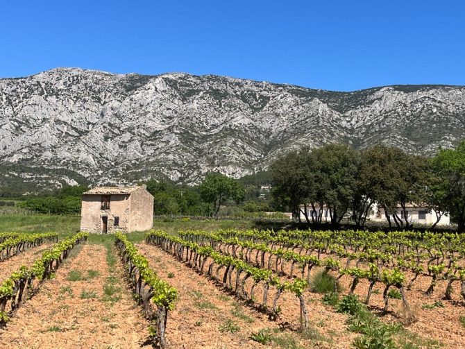
I did the loop counterclockwise, starting on the D 17 that runs south and parallel to Ste-Victoire. It takes a couple kilometres to get out of Aix, through a forest and out into the open and then… there it is, Ste-Victore, rising to an altitude of 1,011 metres. It’s a stand-alone mountain, which is why it’s possible to do a loop all the way around. This southern side of the mountain is a barren, craggy, limestone wall that extends for about 11 miles from west to east (and three or four miles from south to north). Cézanne and his imagination saw colours in these limestone rocks that may or not actually be there. Then again, at different times of the day and year, and depending on the clouds and sun, all things and all colours are possible in these rocks. Who are we to doubt what the great master saw?
Hiking is another way to see the mountain. There are car parks at trail heads every few miles all around the loop.
I remembered the road along the south side of the mountain being fairly flat. It wasn’t. Not even close.
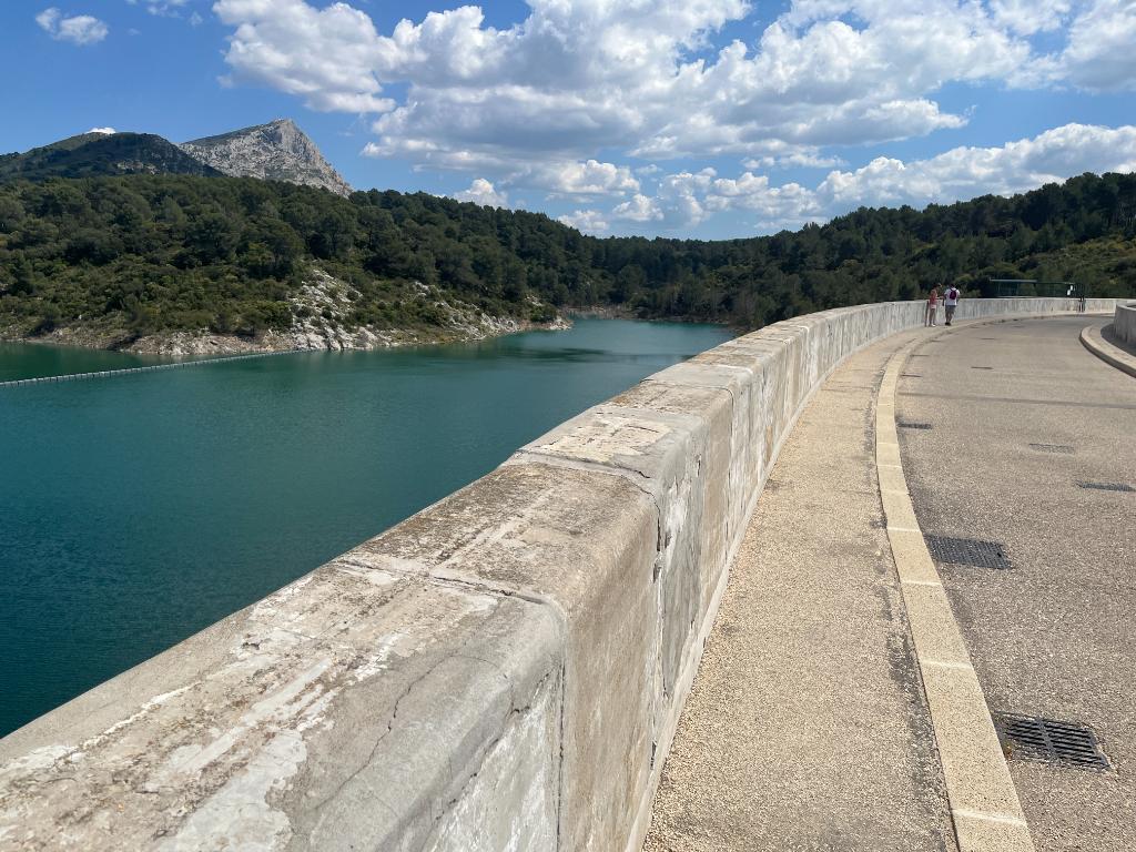
Bimont dam © Steve Wartenberg
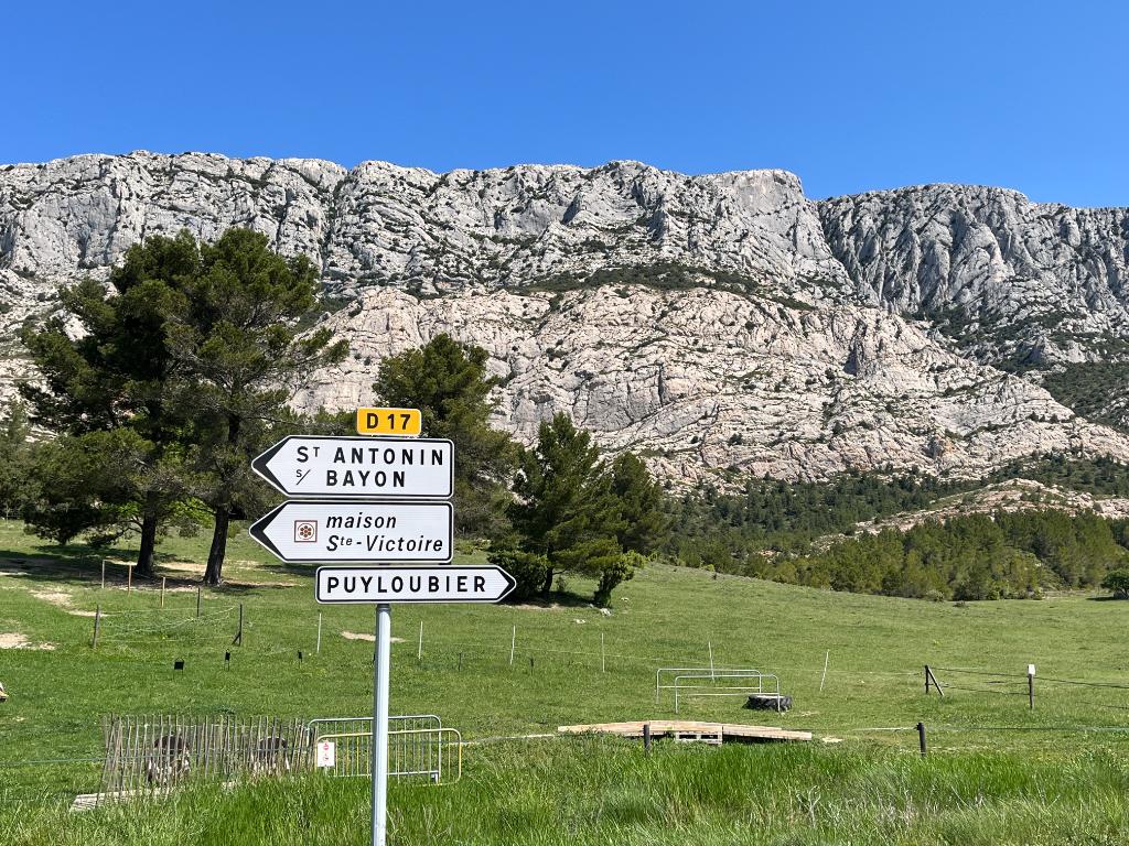
The ride east ends in the town of Pourrières, where there is a supermarché, cafes and restaurants. Then it’s north on the D 23 (toward Rians) and the real climbing begins. After seven kilometres, turn left (east) onto the D 223 (which soon becomes the D 10) and the even more real and steeper climbing begins. The climb tops out at 631 metres and then it’s a bit of a nerve-wracking, adrenaline rush of a descent for five or six kilometres into the town of Vauvenargues.
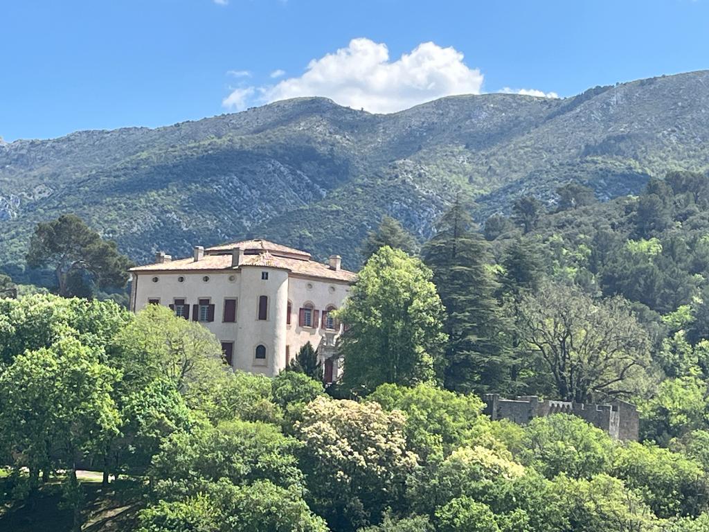
Picasso (1881-1973) bought a castle and painted here for several years. This is where he is buried. The castle is still owned by Picasso’s descendants and is private. No entrance. And yet, there were several people in town who came just to be near where the great artist lived and worked… and to take a photo or two of his chateau.
Bimont dam © Steve Wartenberg
The next stop on the loop is a left onto the access road to the Bimont dam, an engineering marvel completed in 1951. This means Cézanne never saw it, but Picasso may have. I had vivid memories of the vast expanse of the blue water formed in the lake behind the dam, with Ste-Victoire looming in the background. This side, the north side of the mountain, is different than the south side. It’s covered in trees, from bottom to top, while the north side is mostly limestone rock.
While I remembered the lake, I didn’t remember the actual dam structure. And the thing is… it’s right there. An immense concrete wall you can ride (or walk) along. Look in one direction and there are the shimmering blue waters of the lake. Turn around and you can look down into the valley a couple hundred feet below. How could I not remember this?
From the dam, it’s a mostly downhill 7-mile ride back to Aix.
© Steve Wartenberg
Other options, if you’re not quite ready for 40 miles and all that climbing …
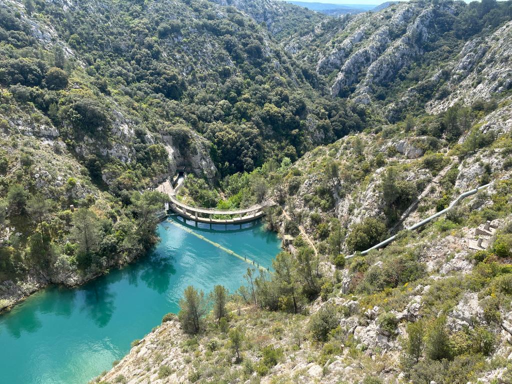
1): Ride the D 10 about 6 miles west to the Bimont dam, bring a picnic lunch and spend some time enjoying the view before heading back to town. At the end of the dam, there’s a path/trail that looks like it leads to some amazing views. There’s an information booth with hiking maps.
2): At the Bimont information booth, the man working there told me many cyclists, riding along the southern edge of Ste-Victorie, take the road south toward Rousset. “You climb up a ridge and there are the best views of the mountain,” he said. I did this ride the next day and the views were spectacular from the top of the ridge and then down (way down) in the valley below. These are the best views of the south side of Ste-Victoire. This ride is 25 to 30 miles depending on whether you ride down into the valley and back up again to get back to Aix. I did and it was quite a climb back up. The second option within this second option is to ride down into the valley, then take the D 57 NE toward Puyloubier where there is a supermarket, cafe and a restaurant. Then take the D 17 back to Aix.
Lead photo credit : © Steve Wartenberg
Share to: Facebook Twitter LinkedIn Email
More in bike trip, Cézanne 2025, cycling, Provence
Related Posts
Leave a reply
Your email address will not be published. Required fields are marked *